
The Role of Drones in Officer and Firefighter Safety: Understanding Sonoran Desert Institute Cost in Public-Safety Aviation

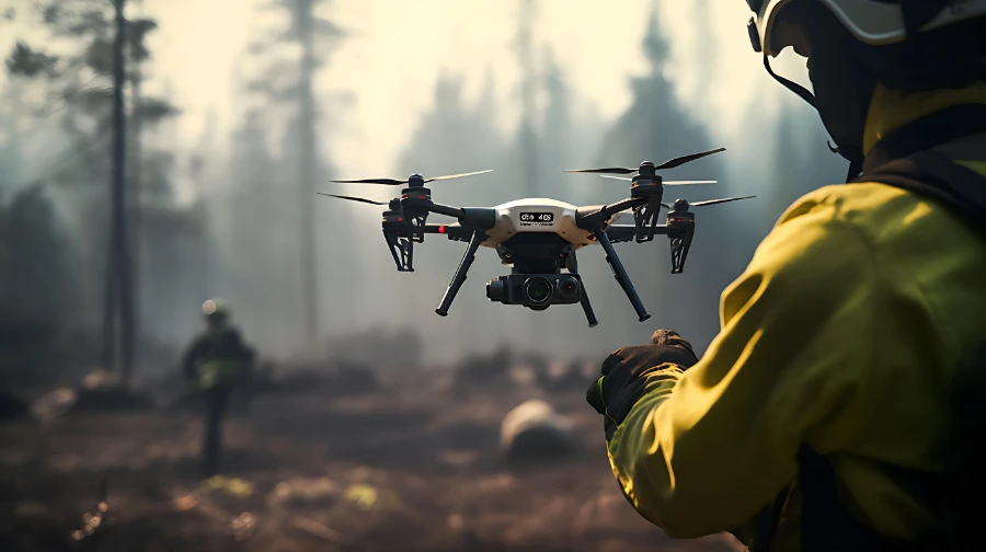
What does the Sonoran Desert Institute cost for students preparing to work in regulated aviation and public-safety drone operations? Emergency scenes expose officers and firefighters to unpredictable hazards long before conditions stabilize. Limited visibility, incomplete information, and rapidly evolving threats increase risk during the earliest moments of response. First responder drone programs reduce that exposure by providing aerial visibility before crews arrive on scene. The Sonoran Desert Institute (SDI), accredited by the Distance Education Accrediting Commission (DEAC), tracks how public-safety agencies integrate aerial assessment into safety planning in addition to on-scene reconnaissance. By viewing incidents from above within minutes of dispatch, agencies identify hazards, adjust tactics, and stage resources with greater precision.
Early visibility alters how responders approach danger. By viewing scenes from above within minutes of dispatch, agencies identify threats, adjust tactics, and stage resources with greater precision. The result is not faster action for its own sake, but informed entry that prioritizes personnel safety across police and fire operations.
Early Assessment Limits Exposure to Unknown Threats
The most dangerous phase of response often occurs before crews understand what awaits them. Dispatch information may lack detail, and conditions can change between the initial call and arrival. Drone feeds replace uncertainty with direct observation. Supervisors assess scene layout, environmental hazards, and human activity while units remain en route. This perspective allows command staff to modify approach routes, select staging areas, and delay entry when conditions suggest elevated risk. Officers and firefighters arrive with clearer expectations rather than relying on rapid on-scene assessment under pressure.
Pre-positioned aircraft support this advantage. Launch pads located within service districts shorten flight time and stabilize arrival intervals. Automated routing guides aircraft through established corridors, maintaining consistent coverage across shifts.
Law Enforcement Uses Aerial Views to Reduce Confrontation Risk
Police operations benefit from early confirmation of threats. Aerial views reveal suspect movement, bystander presence, and access points that remain hidden at ground level. Officers adjust tactics based on verified conditions rather than assumptions. During active calls, drones track movement across yards, rooftops, and alleyways without placing officers in exposed positions.
Command staff monitor developments from a distance, coordinating containment strategies while limiting direct contact. This oversight supports safer perimeter control and reduces the likelihood of sudden confrontations. Visual confirmation also helps identify false alarms or non-threatening situations. Officers downgrade responses when aerial feeds contradict initial reports, limiting unnecessary emergency driving and high-risk entry.
Firefighters Gain Critical Information Before Entry
Fire response carries inherent danger from structural instability, heat buildup, and limited visibility. Aerial imagery provides critical information before crews commit to entry. Thermal sensors reveal heat patterns across roofs and exterior walls, indicating fire location and extension risk. Commanders evaluate roof integrity and ventilation needs while engines stage. These insights guide hose placement, ladder positioning, and crew assignments before exposure increases.
Aerial views also identify secondary hazards such as downed power lines, fuel sources, or blocked access points. Crews approach with awareness of these risks rather than encountering them during the initial attack. Early identification allows incident commanders to adjust entry points and staging areas accordingly. This reduces the likelihood of unexpected obstacles disrupting response efforts.
Safety Planning Extends Beyond Fire Suppression
Firefighter safety also depends on situational awareness during non-fire incidents. Hazardous-materials responses, vehicle collisions, and natural disasters present complex risks. Drones survey spill patterns, debris fields, and unstable terrain from above, supporting safer staging decisions.
During search operations, aerial views locate victims without sending personnel into unsafe areas prematurely. This approach limits exposure to environmental hazards while guiding rescue planning. Thermal imaging and high-resolution visuals help distinguish victims from surrounding terrain or debris. This capability allows teams to focus ground efforts where they are most likely to succeed. It also reduces the risk of secondary injuries by avoiding unnecessary entry into unstable environments.
Preparing Operators for Safety-Driven Drone Operations
As aerial visibility becomes part of routine safety planning, expectations for public safety drone operators expand beyond flight control. Operators are responsible for interpreting sensor data, recognizing risk indicators, and communicating clear, relevant observations to command staff managing multi-agency incidents. These responsibilities are formalized through standard operating procedures that tie aerial activity directly to safety oversight, review, and accountability.
For students preparing to enter these environments, Sonoran Desert Institute cost often factors into broader planning around accessibility and readiness for regulated, safety-focused operations. Preparation centers on understanding how aerial information supports risk management, documentation, and coordinated response rather than isolated technical execution. Training that integrates aviation regulation, sensor interpretation, and unified command coordination reflects how early visibility and informed restraint contribute to reducing exposure for officers and firefighters during active incidents.
Data Governance Supports Responsible Use
Responsible use of aerial visibility depends on how information is governed, not just how it is collected. Public safety agencies establish clear data controls to ensure drone footage supports safety objectives without extending beyond operational need. Geo-fencing confines observation to active incident areas, while camera controls reduce incidental capture outside the response zone. Automated redaction tools remove identifying details before footage is stored or reviewed, reinforcing restraint at the system level.
Agencies keep simple records of when cameras are used and who accesses footage so that decisions can be reviewed later without slowing response. Non-evidentiary video is kept only as long as necessary, following the same retention standards already used for body cameras. These practices protect public trust while allowing departments to keep using drones to reduce risk for officers and firefighters.
Safety Gains from Information, Not Exposure
First responder drones contribute to safety by improving what is known before personnel enter unstable conditions. Early aerial visibility helps officers and firefighters identify hazards, confirm scene conditions, and plan approach routes with clearer context. This added awareness supports deliberate decision-making during the most uncertain phase of response.
As agencies continue to integrate drones into public safety operations, safety planning increasingly prioritizes visibility, coordination, and controlled deployment over speed alone. Aerial assessment becomes part of how risk is managed, not an escalation of it. Used this way, drones serve as a supporting layer that helps reduce unnecessary exposure for those who face danger first, reinforcing safety through information rather than proximity.
Comments are closed.